FlowFinder: Visualizing U.S. Waterways
A simple way to find, view and analyze NOAA National Water Model data and the National Hydrograph Dataset.
Hydrology as a Service
You can get temperature and rain forecast for anywhere, why not for your local rivers?
FlowFinder: Visualizing U.S. Waterways
A simple way to find, view and analyze NOAA National Water Model data and the National Hydrograph Dataset.
Hydrology as a Service
You can get temperature and rain forecast for anywhere, why not for your local rivers?
FlowFinder: Vizualizing U.S. Waterways
A simple way to find, view and analyze NOAA National Water Model data and the National Hydrograph Dataset.
Find
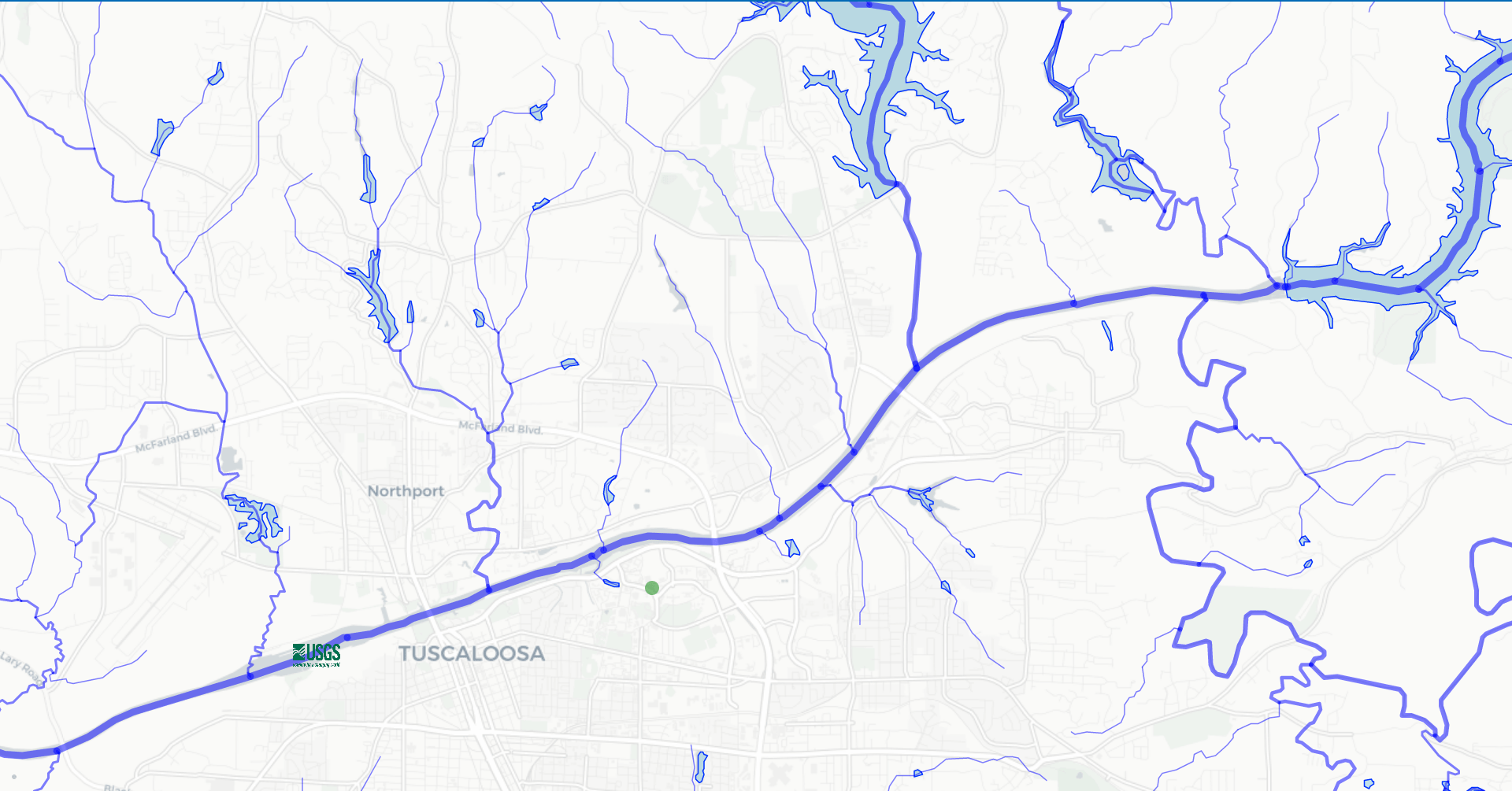
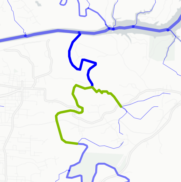
FlowFinder helps you find local stream reaches, water bodies, and USGS stations. The app defaults to your current location, but allows for searches anywhere in the U.S. (using the OpenStreetMap geocoder).
View
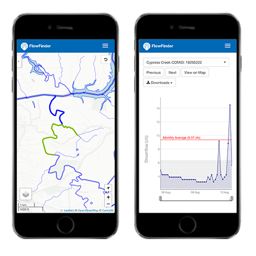
FlowFinder let's you view five day forecasts for all of the ~2.7 million river reaches in the contiguous U.S. from the medium range NOAA National Water Model.
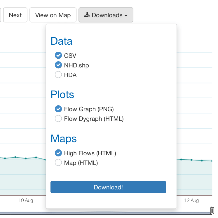
Download
FlowFinder allows all data, maps and plots to be downloaded as csv, rda, shapefile, html, or png where appropriate.
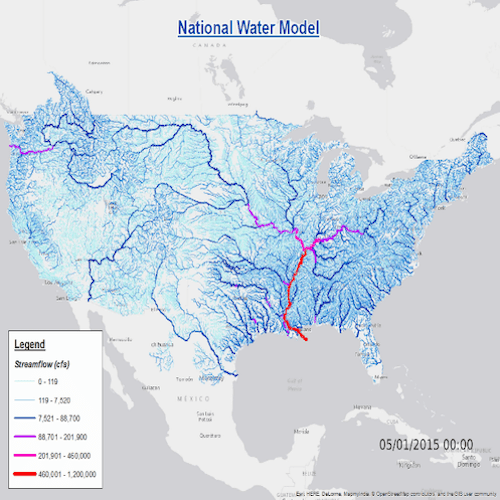
NOAA. National Water Model.
"The National Water Model (NWM) is a hydrologic model that simulates observed and forecast stream flow over the entire continental United States (CONUS). The NWM simulates the water cycle with mathematical representations of the different processes and how they fit together." Learn More.
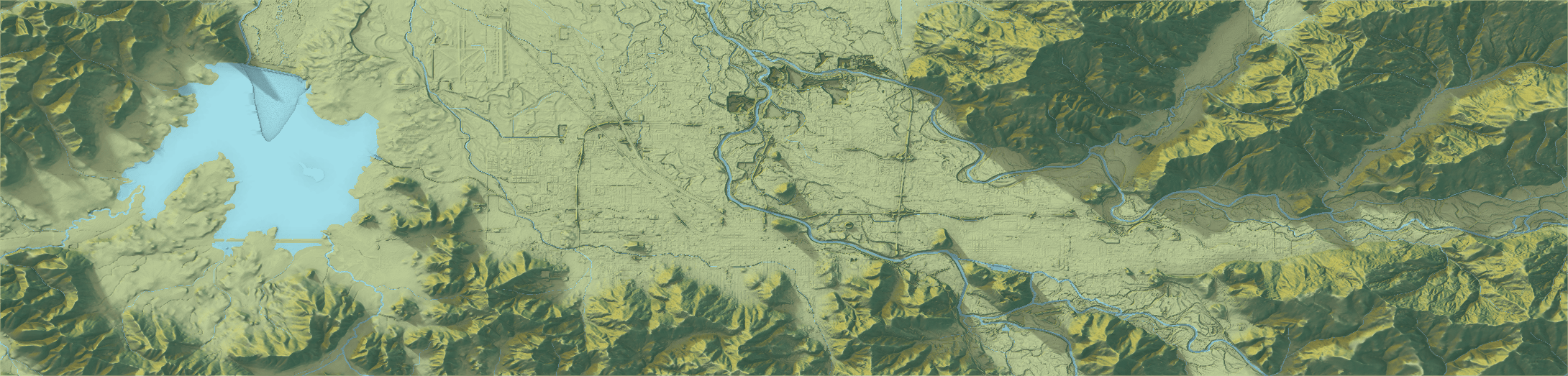
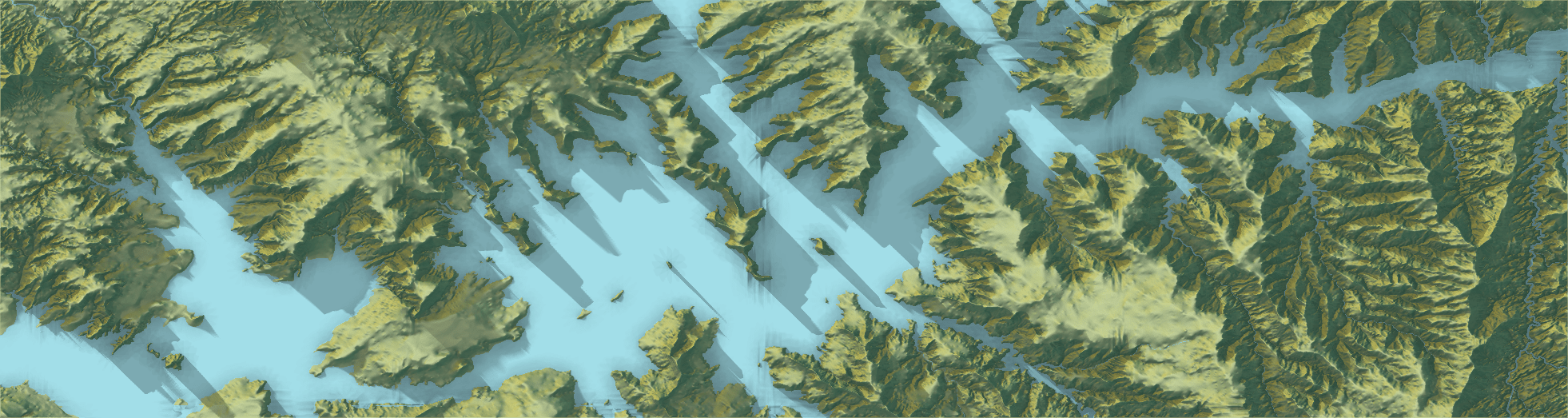
Search local. Find streams near you.
FlowFinder let's you find and visualize hydrologic networks anywhere in the contiguous United States for a 225 square mile area centered on your requested location.
Launch App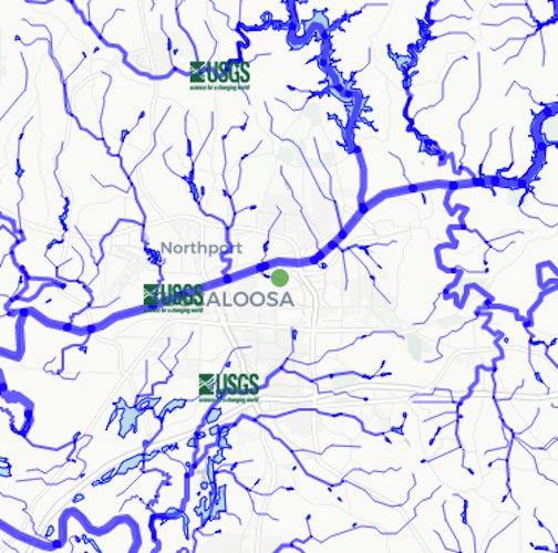
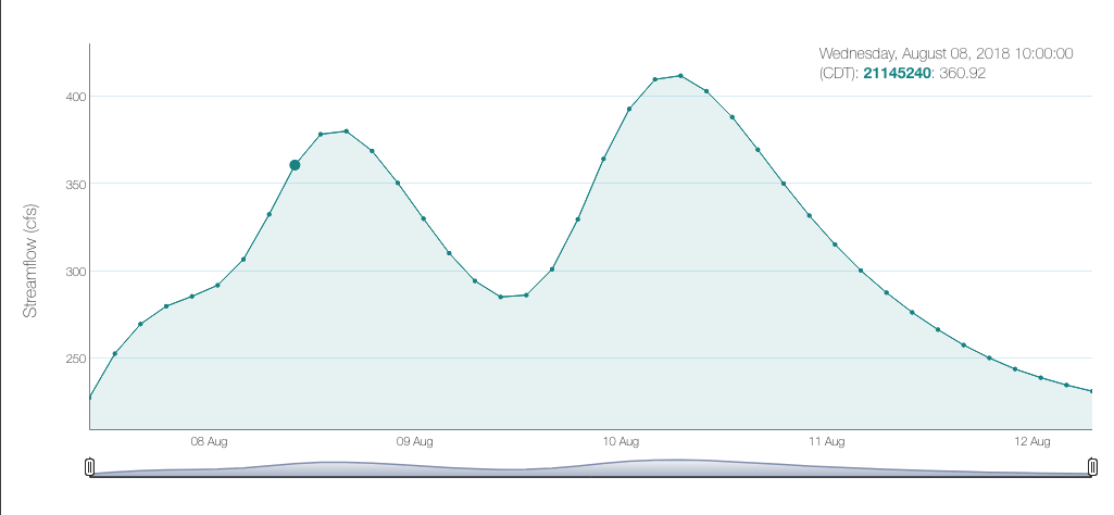
Analyze a reach's predicted flow. Or multiple.
Use the data tab to visualize and compare predicted flows for any reach within your requested area.
Launch App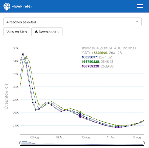
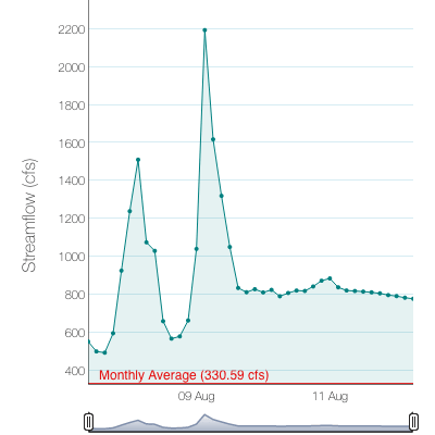
Find unusually high flows. A basis for flood detection.
FlowFinder highlights reaches predicted to experience unusually high flows compared to their long term monthly mean. It reports the location, peak flow, and local time while letting you visualize the forecast.
Launch App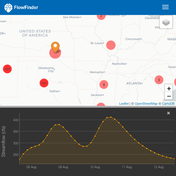
Filter. Find your streams of intereset.
FlowFinder lets you filter and compare stream data on a large scale, making it easy observe overarching patterns or focus on a specif subset of data.
Launch App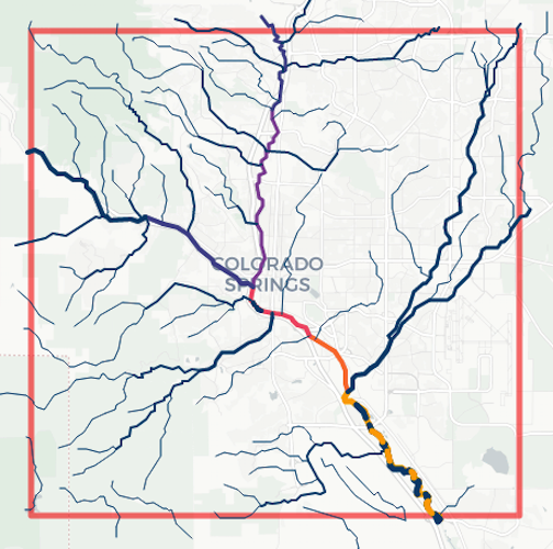
On the move? Go mobile.
FlowFinder was designed with mobile users in mind, making it easy to use whether you're at your desk, in the field, or running errands.
Launch App